

Widespread Regional Alarm Over Upper Basin Infrastructure
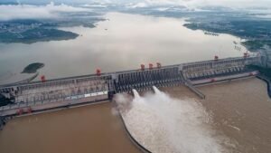
China’s reported plans to construct a series of massive mega-dams along the Yarlung Tsangpo that are the upper reaches of the Brahmaputra River in Tibet. The prospects of this river project has however triggered profound security, ecological and hydrological concerns throughout Northeast India. Because the Brahmaputra serves as an indispensable lifeline for millions of people across downstream regions, any large-scale structural intervention near its source threatens to permanently alter its natural seasonal rhythm, sediment flow and biodiversity.
The sheer magnitude of the proposed upstream developments has reignited urgent policy debates regarding regional stability, potential downstream inundation and the long-term sustainability of fragile riverine ecosystems that sustain local agriculture, fisheries and riverside communities across states like Assam and Arunachal Pradesh. Highlighting the acute environmental vulnerabilities of the region, Professor Devesh Walia from the Department of Geology at North Eastern Hill University emphasised that the Himalayan belt’s delicate geological composition and high level of ongoing seismic activity make massive concrete impoundments inherently dangerous. Unlike conventional engineering projects, mega-structures erected in active tectonic zones face continuous operational risks that extend far beyond the immediate moment of an earthquake, persisting before, during and long after major seismic events occur. As a result, Professor Walia stressed that evaluating structural safety requires going beyond generic regional estimates and conducting rigorous, project-specific probabilistic or deterministic seismic hazard analyses specifically conducive of the unique geological conditions of each proposed dam site.
The Imperative for Transboundary Transparency and Joint Assessment
Drawing comparisons to documented cases of reservoir-induced seismicity, such as those observed in the Koyna region of Maharashtra, Professor Walia warned that a complete lack of transparent, empirical data from upstream developers creates a dangerous divide in how potential disasters are anticipated. In the absence of shared engineering blueprints and geological studies, downstream nations are forced to rely heavily on speculative assumptions, leading to wildly conflicting risk assessments where upstream authorities claim zero impact while downstream communities brace for total catastrophe. To eliminate this critical information gap, the expert urged the Chinese government to proactively share technical, hydrological and geological data directly with the Government of India and independent scientific bodies, ensuring that potential structural hazards can be evaluated collaboratively and objectively before irreparable damage is done.
Cumulative Hydrological Impacts and Downstream Ecological Disruption
Beyond the immediate threats posed by structural dam failure or earthquakes, the cumulative consequences of operating multiple hydroelectric facilities simultaneously pose a severe long-term threat to the entire river basin. Regulating the natural flow of the Brahmaputra could result in unpredictable hydrological shifts, where sudden water releases from upstream reservoirs during heavy monsoon periods could catastrophically amplify flooding in downstream plains, while unseasonal retention could dry up critical tributaries. For regions like Assam, where the river’s dynamic flow sustains fragile wetlands, drives agricultural cycles and forms the bedrock of the local economy, such artificial manipulations risk devastating native aquatic life, accelerating riverbank erosion and endangering the livelihoods of millions who depend on the river for survival.
Distipanna Bhuyan