

Current Developments: The 1-km Eco-Sensitive Zone Proposal Row
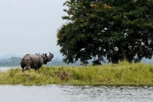
The debate over the conservation radius surrounding Kaziranga National Park and Tiger Reserve has intensified after Assam Chief Minister Himanta Biswa Sarma announced plans to submit a proposal to the Union Ministry of Environment, Forest and Climate Change to establish a site-specific Eco-Sensitive Zone (ESZ) with a baseline width of 1 km to 3 km, down from the default 10 km radius. Addressing a press conference in Guwahati, CM Sarma clarified that the Supreme Court’s reference to a 1 km ESZ does not mean the existing 10 km provision has been automatically scrapped and he stressed that the default 10 km distance will continue to apply until the state government formally notifies the ESZ. Citing the Supreme Court’s April 2023 modified directives, which replaced an earlier blanket 1 km rule to allow state-proposed, tailored limits, the Chief Minister explained that maintaining a rigid 10 km buffer restricts civic infrastructure, urban expansion, housing and public projects in populated peripheral towns like Bokakhat, Jakhalabandha, Kaliabor and Dabaka, giving the example of a proposed modern sports stadium in Bokakhat. Outlining the statutory process, CM Sarma stated that the state Forest Department will prepare a proposal to submit to the Centre and the National Board for Wildlife, noting that a 1 km zone expandable to 3 km depending on circumstances is standard, as seen in the notified ESZ around Deepor Beel and that a 10 km zone is not universally required for every protected area. Meanwhile, the proposal has drawn sharp criticism from environmental activists, local journalists and conservationists, including Padma Shri awardee Jadav Payeng, who argue that shrinking the buffer creates severe regulatory loopholes concerning commercial stone quarrying, riverbed mining in Karbi Anglong catchments and real estate or tourism development along critical animal migration paths utilised during seasonal flooding.

Why Defending the Buffer Matters?
An Eco-Sensitive Zone functions as a shock absorber between core wilderness areas and intensive human development. Treating a dynamic landscape like Kaziranga as an isolated island enclosed by a fixed 1 km boundary disregards foundational ecological facts. First, Kaziranga’s ecosystem relies on annual monsoon flooding from the Brahmaputra River. When the park submerges, thousands of animals, including the greater one-horned rhinoceros, Asian elephants, Royal Bengal tigers and eastern swamp deer must migrate southward across National Highway 37 to the elevated refuges of the Karbi Anglong hills. A narrow 1 km buffer leaves crucial movement corridors unprotected, trapping animals in built-up urban corridors. Second, the rivers flowing through Karbi Anglong sustain the wetlands and grasslands inside the park. Trimming the ESZ exposes surrounding catchments to expanded sand mining, stone quarrying, and industrial runoff, where unregulated upstream activities accelerate siltation and disrupt floodplain hydrology downstream. Third, under MoEFCC guidelines, ESZs are activity-based zones that classify actions into prohibited, regulated and permissible categories rather than banning traditional local living or agriculture. Reducing the regulatory distance lowers legal protections, enabling heavy industrial operations, commercial mining and real estate construction to encroach upon fragile forest borders.
Development vs. Conservation
The framing of conservation as an obstacle to human progress treats natural ecosystems as secondary resources that can be scaled down for immediate economic convenience. Ecosystem services provided by wetlands, natural floodplains and continuous forest corridors such as hydrological stability, flood containment, climate moderation and biodiversity survival are non-negotiable necessities. When development projects swallow these ecological cushions, the resulting human-animal conflict, severe flooding and topsoil loss impose long-term economic and social costs that far outweigh short-term infrastructure gains. Furthermore, nature operates through interconnected hydrological networks and seasonal animal movements rather than straight lines or fixed radial geometries, meaning that defining protection based on rigid political distance rather than ecological evidence exposes fragile borders to degradation. Sustainable urban planning must incorporate nature as a fixed constraint rather than a negotiable perimeter, ensuring civic needs and infrastructure are planned around natural boundaries through activity-based zoning, variable-width buffers and cumulative impact assessments. Treating environmental safety boundaries as negotiable compromises risks compromising the very natural systems that sustain both human settlements and wildlife.
Distipanna Bhuyan